Directional Drilling in Birmingham
A steel city built inside the folded Appalachians — ridges of sandstone, valleys of limestone, an iron seam running through its most famous mountain, and a century of mines beneath its working edges. Birmingham HDD is strike-and-dip drilling in the industrial South's hill country — and it's ours.
HDD is the whole job here
Birmingham's geology is why Birmingham exists: the folded southern Appalachians brought iron ore, coal, and limestone — the whole steel recipe — to the surface within a few miles of each other, and the city grew in Jones Valley with Red Mountain's ore seam as its front porch. For drilling, the folds are the everything: this is not flat-lying rock country. Beds of sandstone, shale, limestone, and dolomite dip and strike across the metro in long northeast-trending bands, so the ground an alignment meets depends on where it sits across the structure — and a bore running across strike can change formations mid-shot. Strike-and-dip quoting names the band, prices the classes, and reads the ridges the way the first ironmasters did: as the geology announcing itself.
The valleys add their own chapter: much of the metro's low ground is carbonate — limestone and dolomite with genuine karst behavior, springs, and the occasional solution cavity — so valley alignments carry void-awareness in the fluid program and the profile. And the industrial century left a subsurface ledger nobody should ignore: mined ground. Red Mountain's ore workings, the coal country running through Walker and western Jefferson, and scattered legacy operations mean that in the historically mined belts, records get pulled and undermining gets asked about before a profile is drawn. It's a scoping question here the way the water table is a scoping question on a coast.
The market itself runs modern: the medical center's campus economy downtown, the US 280 and I-459 corridors' commercial mass, Shelby County's long growth streak, logistics along the interstate spokes, and a metals-and-manufacturing base that never left. Behind it all sits the network desk — 50,000+ boring calls answered, ~10,000 crossings quoted, 2,000+ drilled — pricing Birmingham scope with the folds already in the math.
Fiber-Optic Boring
Campus duct for the medical economy, FTTH through the ridges, corridor backbone.
Electrical Duct Boring
Feeders for campuses, corridors, and a manufacturing base that never left.
Road & Highway Crossings
City, county, and ALDOT crossings — with the bands and the mines in the math.
Water & Force-Main Boring
Fused pressure lines across ridge-and-valley systems, profile-proven in the folds.
Cahaba River Crossings
The signature Birmingham bore: under the South's most storied small river.
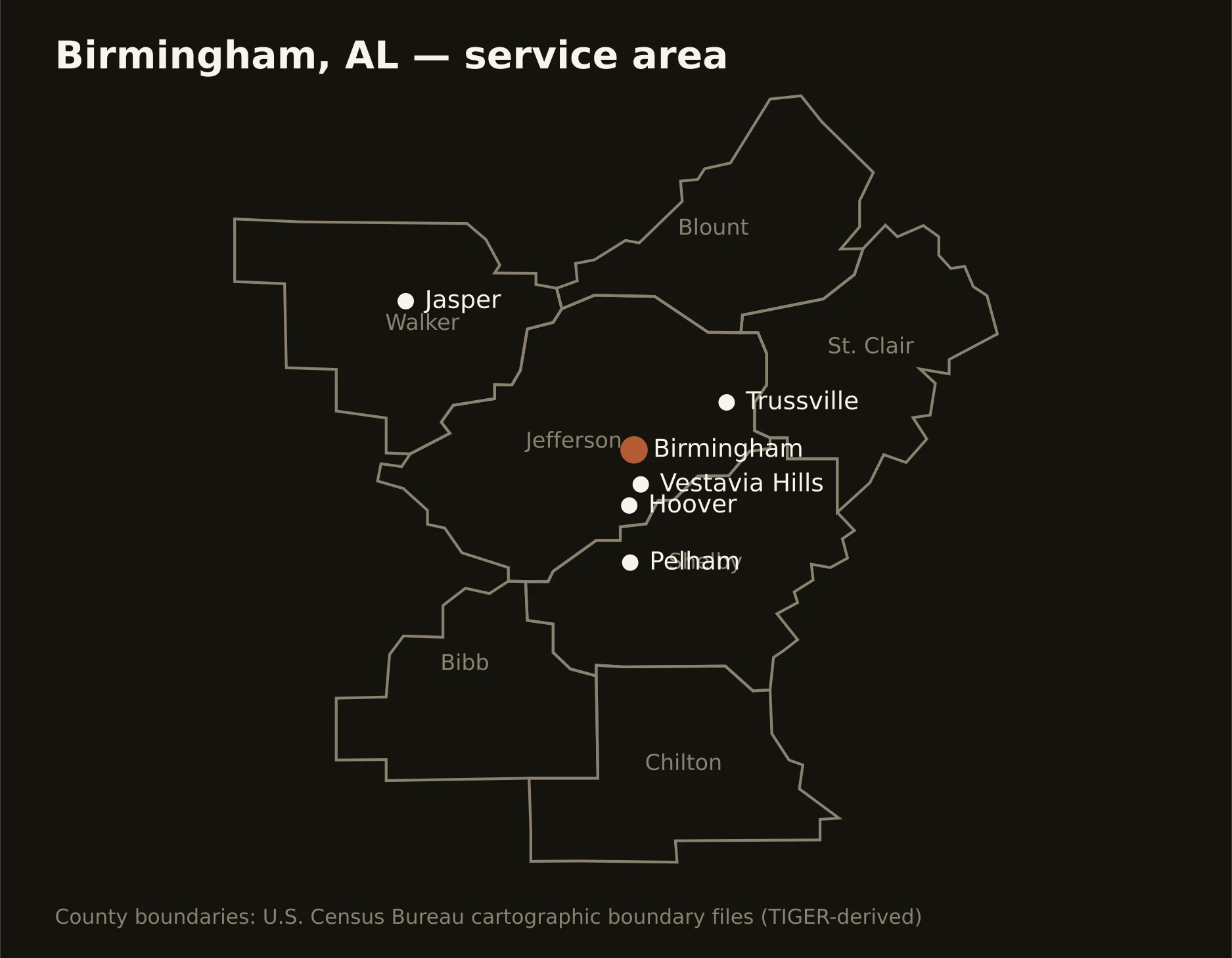
Seven Alabama counties along the Appalachians' last folds — Jefferson's valley-and-ridge core, Shelby's boom running down US 280, St. Clair and Blount holding the northeastern ridges, Walker's coalfield west, and the Cahaba and Coosa country south. Full county list on the service-area page.